Geolocate

Highgate Common topographic map

Click on the map to display elevation.

About this map

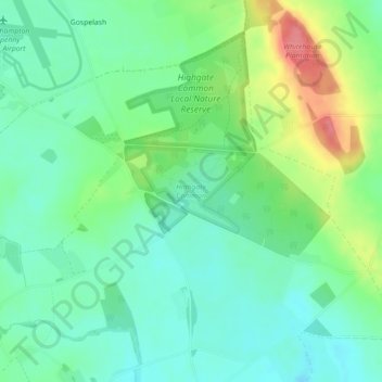
Name: Highgate Common topographic map, elevation, terrain.

Location: Highgate Common, Enville, South Staffordshire, Staffordshire, England, United Kingdom (52.50225 -2.24628 52.50832 -2.23290)

Average elevation: 302 ft

Minimum elevation: 220 ft

Maximum elevation: 479 ft

Other topographic maps

Click on a map to view its topography, its elevation and its terrain.

Gear up for your next adventure:

🧭GPS Watch Accessories - Bands and chargers for GPS watches
🔭Stargazing Telescopes - Perfect for camping in low-light pollution areas shown on maps
🌧️Backpack Rain Cover - Keep gear dry in wet weather
🪶Compact Camp Shovel - Folding shovel for campsite tasks
👟Men's Trail Runners - Lightweight footwear for fast-paced exploration and light hiking

As an Amazon Associate, this site earns from qualifying purchases at no extra cost to you.