Geolocate

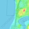
Ardross topographic map

Click on the map to display elevation.

About this map

Name: Ardross topographic map, elevation, terrain.

Location: Ardross, Perth, Western Australia, 6153, Australia (-32.03352 115.82425 -32.01747 115.84429)

Average elevation: 62 ft

Minimum elevation: -3 ft

Maximum elevation: 154 ft

Other topographic maps

Click on a map to view its topography, its elevation and its terrain.

Geo Lithgo Park

Australia > Western Australia > Perth

Average elevation: 92 ft

Mosman Beach

Australia > Western Australia > Perth

Average elevation: 30 ft

Canning river

Australia > Western Australia > Perth

Average elevation: 961 ft

Reabold Hill

Australia > Western Australia > Perth

Average elevation: 105 ft

Mundaring Weir

Australia > Western Australia > Perth

Average elevation: 607 ft

Adenia Lagoon

Australia > Western Australia > Perth

Average elevation: 30 ft

Lake Gwelup

Australia > Western Australia > Perth

Average elevation: 82 ft

Lake Claremont

Australia > Western Australia > Perth

Average elevation: 72 ft

Woodford Park

Australia > Western Australia > Perth

Average elevation: 36 ft

Hatfield Park

Australia > Western Australia > Perth

Average elevation: 79 ft

Brittania Reserve

Australia > Western Australia > Perth

Average elevation: 82 ft

Alderley Park

Australia > Western Australia > Perth

Average elevation: 33 ft

Bold Park

Australia > Western Australia > Perth

Average elevation: 112 ft

Gear up for your next adventure:

🦶Hiking Gaiters - Keep debris and water out of your boots
🎒Trekking Poles - Sturdy poles for balance and stability on rough terrain
🔪Outdoor Multitools - Essential survival tools for gear repair and field use
🥘Titanium Cookware - Durable, featherlight pots and pans for backpacking
🌡️Handheld Weather Meters - Measure wind, temp, and pressure for safe mountain travel

As an Amazon Associate, this site earns from qualifying purchases at no extra cost to you.