Geolocate

Kingsley topographic map

Click on the map to display elevation.

About this map
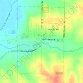
Name: Kingsley topographic map, elevation, terrain.

Location: Kingsley, Plymouth County, Iowa, United States (42.57427 -95.98316 42.59788 -95.95725)

Average elevation: 1,266 ft

Minimum elevation: 1,194 ft

Maximum elevation: 1,368 ft

Plymouth County trails, hiking, mountain biking, running and outdoor activities

Other topographic maps

Click on a map to view its topography, its elevation and its terrain.

James

United States > Iowa > Plymouth County

Average elevation: 1,194 ft

Gear up for your next adventure:

🕶️Glacier Sunglasses - Side shields to protect eyes from high-altitude snow glare
📻Weather Alert Radios - Stay informed of storm risks while off-the-grid
🏫Relief Map Kits - Hands-on tools for teaching landforms and elevation
🪶Paracord Bracelet - Survival bracelet with built‑in tools
🧦Merino Wool Socks - Moisture-wicking, blister-preventing socks for long treks

As an Amazon Associate, this site earns from qualifying purchases at no extra cost to you.