
Thank you for supporting this site ❤️
Make a donation
Make a donation
Gear up for your next adventure:
As an Amazon Associate, this site earns from qualifying purchases at no extra cost to you.
Lingshou County topographic map
Click on the map to display elevation.
Thank you for supporting this site ❤️
Make a donation
Make a donation
Gear up for your next adventure:
As an Amazon Associate, this site earns from qualifying purchases at no extra cost to you.
About this map
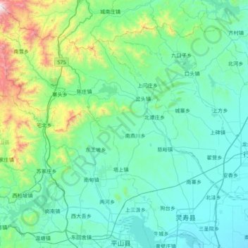
Name: Lingshou County topographic map, elevation, terrain.
Location: Lingshou County, Shijiazhuang City, Hebei, China (38.24290 113.82303 38.75807 114.47905)
Average elevation: 1,047 ft
Minimum elevation: 272 ft
Maximum elevation: 5,879 ft
Thank you for supporting this site ❤️
Make a donation
Make a donation
Gear up for your next adventure:
As an Amazon Associate, this site earns from qualifying purchases at no extra cost to you.