
Eja topographic map
Interactive map
Click on the map to display elevation.
About this map
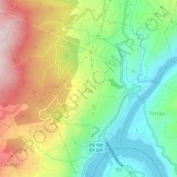
Name: Eja topographic map, elevation, terrain.
Location: Eja, Penafiel, Porto, Portugal (41.07554 -8.31733 41.10375 -8.28538)
Average elevation: 604 ft
Minimum elevation: 20 ft
Maximum elevation: 1,417 ft
Other topographic maps
Click on a map to view its topography, its elevation and its terrain.