Geolocate

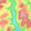
Villemoron topographic map

Click on the map to display elevation.

About this map

Name: Villemoron topographic map, elevation, terrain.

Location: Villemoron, Vals-des-Tilles, Langres, Haute-Marne, Grand Est, France métropolitaine, 52160, France (47.65049 5.08312 47.69049 5.12312)

Average elevation: 1,355 ft

Minimum elevation: 1,043 ft

Maximum elevation: 1,578 ft

Other topographic maps

Click on a map to view its topography, its elevation and its terrain.

Musseau

France > Grand Est > Haute-Marne > Vals-des-Tilles

Average elevation: 1,457 ft

Villemervry

France > Grand Est > Haute-Marne > Vals-des-Tilles

Average elevation: 1,381 ft

Gear up for your next adventure:

🩹Survival Bandages - High‑quality bandages for emergencies
🔦Powerful Headlamps - Ultra-bright hands-free lighting for night navigation
🔌Solar Panel Charger - Charge gear sustainably outdoors
🧼Biodegradable Camping Soap - Eco‑friendly soap for outdoor hygiene
🧥Waterproof Jacket for Hiking - Breathable and rugged rain jacket for outdoor excursions

As an Amazon Associate, this site earns from qualifying purchases at no extra cost to you.