
Cristo Rey topographic map
Interactive map
Click on the map to display elevation.
About this map
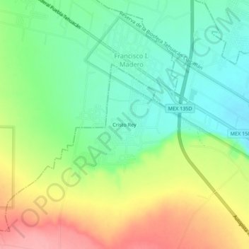
Name: Cristo Rey topographic map, elevation, terrain.
Location: Cristo Rey, Tehuacán, Puebla, 75809, México (18.46278 -97.48583 18.50278 -97.44583)
Average elevation: 5,650 ft
Minimum elevation: 5,512 ft
Maximum elevation: 5,856 ft
Other topographic maps
Click on a map to view its topography, its elevation and its terrain.
Valsequillo
México > Puebla > Tehuacán > Tehuacán
Valsequillo, Tehuacán, Puebla, 75700, México
Average elevation: 5,433 ft