
Onguday topographic map
Interactive map
Click on the map to display elevation.
About this map
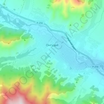
Name: Onguday topographic map, elevation, terrain.
Average elevation: 3,156 ft
Minimum elevation: 2,641 ft
Maximum elevation: 5,282 ft
Other topographic maps
Click on a map to view its topography, its elevation and its terrain.
Onguday
Russia > Altai Republic > Ongudaysky Rayon > Onguday
Onguday, Онгудайское сельское поселение, Ongudaysky Rayon, Altai Republic, Siberian Federal District, 649440, Russia
Average elevation: 3,428 ft