
Farmingville topographic map
Click on the map to display elevation.
About this map
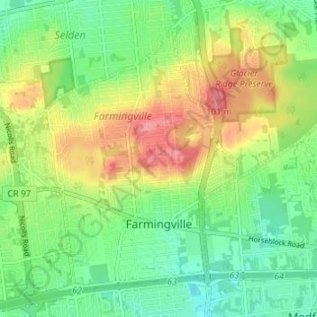
Name: Farmingville topographic map, elevation, terrain.
Average elevation: 157 ft
Minimum elevation: 52 ft
Maximum elevation: 308 ft
Suffolk County trails, hiking, mountain biking, running and outdoor activities
Other topographic maps
Click on a map to view its topography, its elevation and its terrain.
Stony Brook University
United States > New York > Suffolk County > Town of Brookhaven
Average elevation: 151 ft
Port Jefferson Harbor
United States > New York > Suffolk County > Town of Brookhaven
Average elevation: 33 ft