Geolocate

Owasa topographic map

Click on the map to display elevation.

About this map

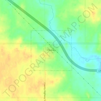
Name: Owasa topographic map, elevation, terrain.

Location: Owasa, Hardin County, Iowa, United States (42.42638 -93.21206 42.43712 -93.19727)

Average elevation: 1,109 ft

Minimum elevation: 1,056 ft

Maximum elevation: 1,155 ft

Hardin County trails, hiking, mountain biking, running and outdoor activities

Other topographic maps

Click on a map to view its topography, its elevation and its terrain.

Garden City

United States > Iowa > Hardin County

Average elevation: 1,178 ft

Gifford

United States > Iowa > Hardin County

Average elevation: 971 ft

Gear up for your next adventure:

📶Vehicle Signal Boosters - Improve reception in rural areas while driving to trailheads
🛰️Handheld GPS Units - Professional satellite navigators for precise backcountry mapping
🗺️Topographic Maps - Detailed topo maps for hiking, exploring and outdoor navigation
🪵Folding Camp Saw - Compact saw for wood and campsite work
🔦Compact Flashlight - Reliable flashlight for emergencies

As an Amazon Associate, this site earns from qualifying purchases at no extra cost to you.