
Berrys topographic map
Click on the map to display elevation.
About this map
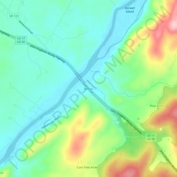
Name: Berrys topographic map, elevation, terrain.
Location: Berrys, Clarke County, Virginia, 22646, United States (39.01872 -78.01666 39.05872 -77.97666)
Average elevation: 614 ft
Minimum elevation: 400 ft
Maximum elevation: 1,106 ft
Clarke County trails, hiking, mountain biking, running and outdoor activities
Other topographic maps
Click on a map to view its topography, its elevation and its terrain.
University of Virginia Blandy Experimental Farm and Virginia State Arboretum
United States > Virginia > Clarke County > Boyce > Greenway Estates
Average elevation: 594 ft