Geolocate

Jerome topographic map

Click on the map to display elevation.

About this map

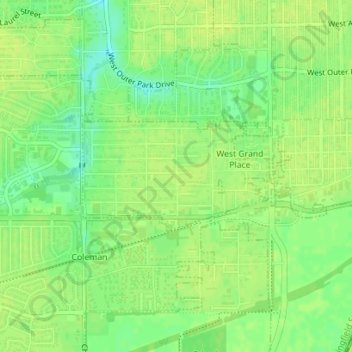
Name: Jerome topographic map, elevation, terrain.

Location: Jerome, Sangamon County, Illinois, United States (39.76310 -89.68693 39.77154 -89.66814)

Average elevation: 607 ft

Minimum elevation: 568 ft

Maximum elevation: 623 ft

Sangamon County trails, hiking, mountain biking, running and outdoor activities

Other topographic maps

Click on a map to view its topography, its elevation and its terrain.

Farmingdale

United States > Illinois > Sangamon County

Average elevation: 591 ft

Bates

United States > Illinois > Sangamon County

Average elevation: 636 ft

Gear up for your next adventure:

🧣Hiking Neck Gaiter - Multi‑use neck protection for outdoor weather
🔋Solar Power Banks - Keep your GPS and phone charged in remote wilderness areas
🌄Hiking Binoculars - Compact binoculars for scenic views and trail spotting
🎒Outdoor Daypacks - Lightweight backpacks designed for carrying maps and essential gear
🔋Rechargeable Batteries - Power up your outdoor devices

As an Amazon Associate, this site earns from qualifying purchases at no extra cost to you.