
Thank you for supporting this site ❤️
Make a donation
Make a donation
Gear up for your next adventure:
As an Amazon Associate, this site earns from qualifying purchases at no extra cost to you.
Zapotitlán topographic map
Click on the map to display elevation.
Thank you for supporting this site ❤️
Make a donation
Make a donation
Gear up for your next adventure:
As an Amazon Associate, this site earns from qualifying purchases at no extra cost to you.
About this map
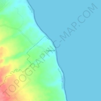
Name: Zapotitlán topographic map, elevation, terrain.
Location: Zapotitlán, Tatahuicapan de Juárez, Veracruz, México (18.48306 -94.80889 18.52306 -94.76889)
Average elevation: 52 ft
Minimum elevation: -3 ft
Maximum elevation: 266 ft
Thank you for supporting this site ❤️
Make a donation
Make a donation
Gear up for your next adventure:
As an Amazon Associate, this site earns from qualifying purchases at no extra cost to you.