
Thank you for supporting this site ❤️
Make a donation
Make a donation
Gear up for your next adventure:
As an Amazon Associate, this site earns from qualifying purchases at no extra cost to you.
Shahdad topographic map
Click on the map to display elevation.
Thank you for supporting this site ❤️
Make a donation
Make a donation
Gear up for your next adventure:
As an Amazon Associate, this site earns from qualifying purchases at no extra cost to you.
About this map
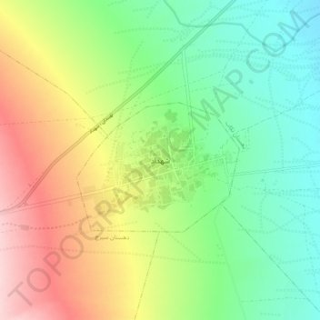
Name: Shahdad topographic map, elevation, terrain.
Location: Shahdad, بخش شهداد, Kerman County, Kerman Province, Iran (30.37964 57.66237 30.45964 57.74237)
Average elevation: 1,483 ft
Minimum elevation: 1,207 ft
Maximum elevation: 1,913 ft
Thank you for supporting this site ❤️
Make a donation
Make a donation
Gear up for your next adventure:
As an Amazon Associate, this site earns from qualifying purchases at no extra cost to you.