
Nedrow topographic map
Click on the map to display elevation.
About this map
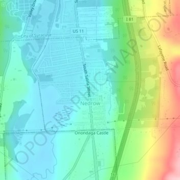
Name: Nedrow topographic map, elevation, terrain.
Average elevation: 571 ft
Minimum elevation: 413 ft
Maximum elevation: 1,017 ft
Onondaga County trails, hiking, mountain biking, running and outdoor activities
Other topographic maps
Click on a map to view its topography, its elevation and its terrain.
Howlett Hill
United States > New York > Onondaga County > Town of Onondaga > Howlett Hill
Average elevation: 889 ft
Onondaga Hill
United States > New York > Onondaga County > Town of Onondaga > Onondaga Hill
Average elevation: 797 ft