Geolocate

Puschwitz topographic map

Click on the map to display elevation.

About this map

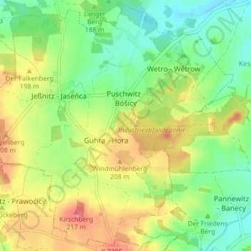
Name: Puschwitz topographic map, elevation, terrain.

Location: Puschwitz, Wetro, Neschwitz, Bautzen, Sachsen, Deutschland (51.22626 14.25527 51.26520 14.31982)

Average elevation: 600 ft

Minimum elevation: 502 ft

Maximum elevation: 725 ft

Gear up for your next adventure:

📶Vehicle Signal Boosters - Improve reception in rural areas while driving to trailheads
❄️Traction Cleats - Prevent slips on icy trails during winter hikes
📚USA Hiking Guide Books - Top trail guides and map books
🔋Solar Power Banks - Keep your GPS and phone charged in remote wilderness areas
🧴Hand Sanitizer - Keep hands clean while hiking

As an Amazon Associate, this site earns from qualifying purchases at no extra cost to you.