
Thank you for supporting this site ❤️
Make a donation
Make a donation
Gear up for your next adventure:
As an Amazon Associate, this site earns from qualifying purchases at no extra cost to you.
Weiskirchen topographic map
Click on the map to display elevation.
Thank you for supporting this site ❤️
Make a donation
Make a donation
Gear up for your next adventure:
As an Amazon Associate, this site earns from qualifying purchases at no extra cost to you.
About this map
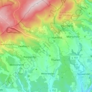
Name: Weiskirchen topographic map, elevation, terrain.
Location: Weiskirchen, Landkreis Merzig-Wadern, Sarre, 66709, Allemagne (49.50823 6.75730 49.59205 6.85135)
Average elevation: 1,309 ft
Minimum elevation: 833 ft
Maximum elevation: 2,293 ft
Thank you for supporting this site ❤️
Make a donation
Make a donation
Gear up for your next adventure:
As an Amazon Associate, this site earns from qualifying purchases at no extra cost to you.