
Thank you for supporting this site ❤️
Make a donation
Make a donation
Gear up for your next adventure:
As an Amazon Associate, this site earns from qualifying purchases at no extra cost to you.
Jarmundi topographic map
Click on the map to display elevation.
Thank you for supporting this site ❤️
Make a donation
Make a donation
Gear up for your next adventure:
As an Amazon Associate, this site earns from qualifying purchases at no extra cost to you.
About this map
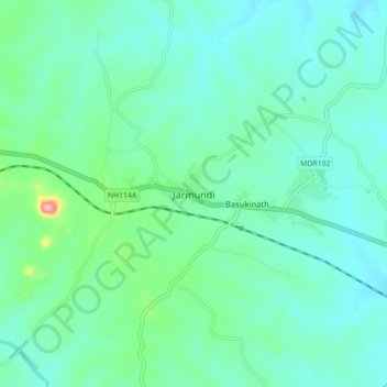
Name: Jarmundi topographic map, elevation, terrain.
Location: Jarmundi, Dumka, Jharkhand, 814141, India (24.35174 87.01813 24.43174 87.09813)
Average elevation: 666 ft
Minimum elevation: 548 ft
Maximum elevation: 1,188 ft
Thank you for supporting this site ❤️
Make a donation
Make a donation
Gear up for your next adventure:
As an Amazon Associate, this site earns from qualifying purchases at no extra cost to you.