
Thank you for supporting this site ❤️
Make a donation
Make a donation
Gear up for your next adventure:
As an Amazon Associate, this site earns from qualifying purchases at no extra cost to you.
Montserrat topographic map
Click on the map to display elevation.
Thank you for supporting this site ❤️
Make a donation
Make a donation
Gear up for your next adventure:
As an Amazon Associate, this site earns from qualifying purchases at no extra cost to you.
About this map
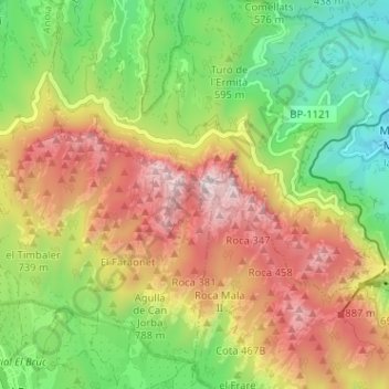
Name: Montserrat topographic map, elevation, terrain.
Location: Montserrat, Marganell, Bages, Barcelona, Catalonia, Spain (41.59409 1.78005 41.61292 1.84382)
Average elevation: 2,110 ft
Minimum elevation: 545 ft
Maximum elevation: 4,016 ft
Thank you for supporting this site ❤️
Make a donation
Make a donation
Gear up for your next adventure:
As an Amazon Associate, this site earns from qualifying purchases at no extra cost to you.