
Thank you for supporting this site ❤️
Make a donation
Make a donation
Gear up for your next adventure:
As an Amazon Associate, this site earns from qualifying purchases at no extra cost to you.
Sasaima topographic map
Click on the map to display elevation.
Thank you for supporting this site ❤️
Make a donation
Make a donation
Gear up for your next adventure:
As an Amazon Associate, this site earns from qualifying purchases at no extra cost to you.
About this map
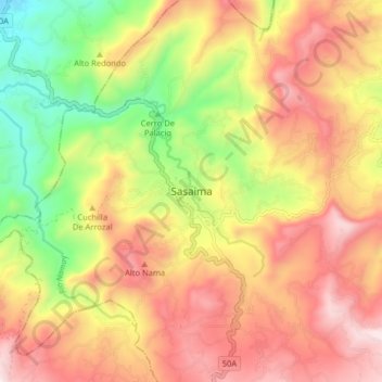
Name: Sasaima topographic map, elevation, terrain.
Location: Sasaima, Gualivá, RAP (Especial) Central, Colombie (4.92458 -74.47312 5.00458 -74.39312)
Average elevation: 4,252 ft
Minimum elevation: 2,598 ft
Maximum elevation: 5,692 ft
Thank you for supporting this site ❤️
Make a donation
Make a donation
Gear up for your next adventure:
As an Amazon Associate, this site earns from qualifying purchases at no extra cost to you.