
Santa Fe topographic map
Interactive map
Click on the map to display elevation.
About this map
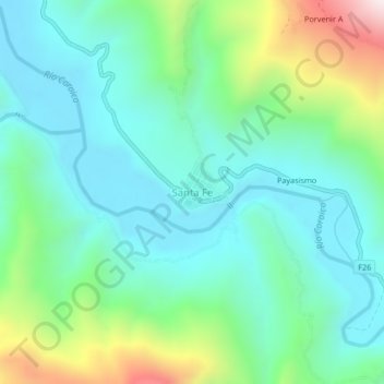
Name: Santa Fe topographic map, elevation, terrain.
Location: Santa Fe, Caranavi, La Paz, Bolivia (-15.82916 -67.64489 -15.78916 -67.60489)
Average elevation: 2,448 ft
Minimum elevation: 1,736 ft
Maximum elevation: 4,554 ft
Other topographic maps
Click on a map to view its topography, its elevation and its terrain.
Taypiplaya
Bolivia > La Paz > Caranavi > Caranavi
Taypiplaya, Caranavi, La Paz, Bolivia
Average elevation: 3,310 ft