
Furfooz topographic map
Click on the map to display elevation.
About this map
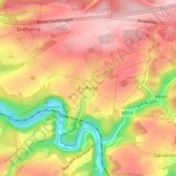
Name: Furfooz topographic map, elevation, terrain.
Location: Furfooz, Dinant, Namur, Wallonia, 5561, Belgium (50.20341 4.93991 50.24341 4.97991)
Average elevation: 712 ft
Minimum elevation: 318 ft
Maximum elevation: 961 ft
Other topographic maps
Click on a map to view its topography, its elevation and its terrain.