Geolocate

Anhée topographic map

Click on the map to display elevation.

About this map

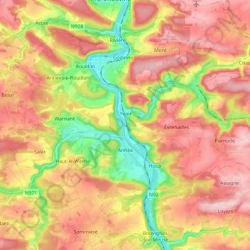
Name: Anhée topographic map, elevation, terrain.

Location: Anhée, Dinant, Namur, Wallonia, 5537, Belgium (50.28010 4.72630 50.36175 4.89684)

Average elevation: 650 ft

Minimum elevation: 256 ft

Maximum elevation: 965 ft

Other topographic maps

Click on a map to view its topography, its elevation and its terrain.

Maredsous

Belgium > Namur > Dinant > Sosoye

Average elevation: 748 ft

Somal

Belgium > Namur > Dinant

Average elevation: 866 ft

Campagne

Belgium > Namur > Dinant > Celles

Average elevation: 810 ft

Dinant

Belgium > Namur > Dinant > Dinant

Average elevation: 669 ft

Sevry

Belgium > Namur > Dinant

Average elevation: 902 ft

Furfooz

Belgium > Namur > Dinant

Average elevation: 712 ft

Gear up for your next adventure:

🪶Fire Starter Kit - Reliable fire starter for survival and camping
🎒Day Hiking Backpack - Lightweight backpack perfect for day trips and outdoor adventures
🔪Outdoor Multitools - Essential survival tools for gear repair and field use
🔦Powerful Headlamps - Ultra-bright hands-free lighting for night navigation
🎁Geography Themed Gifts - Unique gift ideas for map lovers and geography enthusiasts

As an Amazon Associate, this site earns from qualifying purchases at no extra cost to you.