
Atlacholoaya topographic map
Interactive map
Click on the map to display elevation.
About this map
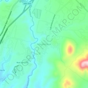
Name: Atlacholoaya topographic map, elevation, terrain.
Location: Atlacholoaya, Xochitepec, Morelos, 62772, México (18.72422 -99.24609 18.76422 -99.20609)
Average elevation: 3,622 ft
Minimum elevation: 3,346 ft
Maximum elevation: 4,472 ft
Other topographic maps
Click on a map to view its topography, its elevation and its terrain.
Chiconcuac
México > Morelos > Xochitepec
Chiconcuac, Xochitepec, Morelos, 62790, México
Average elevation: 3,773 ft