
Thank you for supporting this site ❤️
Make a donation
Make a donation
Gear up for your next adventure:
As an Amazon Associate, this site earns from qualifying purchases at no extra cost to you.
A Pastoriza topographic map
Click on the map to display elevation.
Thank you for supporting this site ❤️
Make a donation
Make a donation
Gear up for your next adventure:
As an Amazon Associate, this site earns from qualifying purchases at no extra cost to you.
About this map
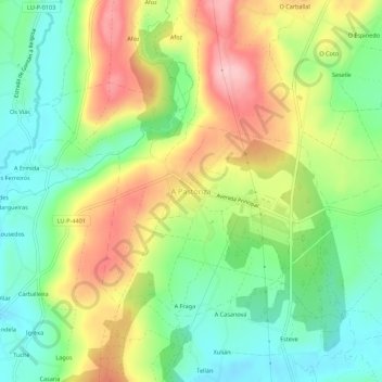
Name: A Pastoriza topographic map, elevation, terrain.
Location: A Pastoriza, Tierra Chá, Lugo, Galicia, 27286, España (43.28000 -7.37110 43.32000 -7.33110)
Average elevation: 1,670 ft
Minimum elevation: 1,427 ft
Maximum elevation: 2,005 ft
Thank you for supporting this site ❤️
Make a donation
Make a donation
Gear up for your next adventure:
As an Amazon Associate, this site earns from qualifying purchases at no extra cost to you.