Geolocate

Poró topographic map

Click on the map to display elevation.

About this map

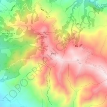
Name: Poró topographic map, elevation, terrain.

Location: Poró, Grifo Alto, Puriscal, San José, 10404, Costa Rica (9.86760 -84.43326 9.90760 -84.39326)

Average elevation: 2,320 ft

Minimum elevation: 1,145 ft

Maximum elevation: 3,327 ft

Gear up for your next adventure:

🪶Multi‑Purpose Knife - Useful blade for camp and trail
🛠️Backpacking Tool Kit - Essential toolkit for outdoor repairs
🧦Merino Wool Socks - Moisture-wicking, blister-preventing socks for long treks
📦Gear Storage Bags - Organize and protect outdoor equipment
🧯Portable Fire Pit - Compact fire pit for camping spots

As an Amazon Associate, this site earns from qualifying purchases at no extra cost to you.