Geolocate

Santa Cruz topographic map

Click on the map to display elevation.

About this map

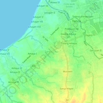
Name: Santa Cruz topographic map, elevation, terrain.

Location: Santa Cruz, Tanza, Cavite, Calabarzon, 4108, Philippines (14.36939 120.82809 14.40939 120.86809)

Average elevation: 39 ft

Minimum elevation: 0 ft

Maximum elevation: 95 ft

Gear up for your next adventure:

🍳Camping Cook Set - Complete cookware for outdoor meals
🪶Survival Guide Book - Expert advice for emergency preparedness
📦Dry Bags Set - Waterproof storage for electronics and clothes
Solar GPS Watches - Advanced multisport watches with built-in topographic maps
🧺Microfiber Travel Towels - Compact and fast-drying towels for trail use

As an Amazon Associate, this site earns from qualifying purchases at no extra cost to you.