Geolocate

Prusia topographic map

Click on the map to display elevation.

About this map

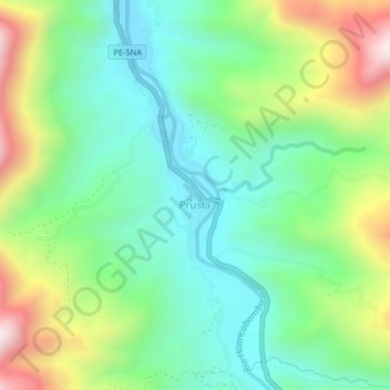
Name: Prusia topographic map, elevation, terrain.

Location: Prusia, Pozuzo, Province of Oxapampa, Pasco, 19251, Peru (-10.11680 -75.56255 -10.07680 -75.52255)

Average elevation: 3,245 ft

Minimum elevation: 2,356 ft

Maximum elevation: 5,082 ft

Gear up for your next adventure:

🩹Survival Bandages - High‑quality bandages for emergencies
🛡️Bear Spray Outdoor - Protection in bear country hikes
🍳Camping Cook Set - Complete cookware for outdoor meals
🗺️NatGeo Topo Maps - High-quality waterproof printed topographic maps of US Parks
🧤Hiking Gloves - Protective gloves for rugged trails

As an Amazon Associate, this site earns from qualifying purchases at no extra cost to you.