
Make a donation
Gear up for your next adventure:
As an Amazon Associate, this site earns from qualifying purchases at no extra cost to you.
Dormaal topographic map
Click on the map to display elevation.
Make a donation
Gear up for your next adventure:
As an Amazon Associate, this site earns from qualifying purchases at no extra cost to you.
Dormaal
Dormaal ligt aan de noordgrens van de Haspengouw op een hoogte van 35-65 meter. De plaats ligt aan de Molenbeek of Dormaalbeek welke naar het noorden stroomt en in de Kleine Gete uitmondt.
Make a donation
Gear up for your next adventure:
As an Amazon Associate, this site earns from qualifying purchases at no extra cost to you.
About this map
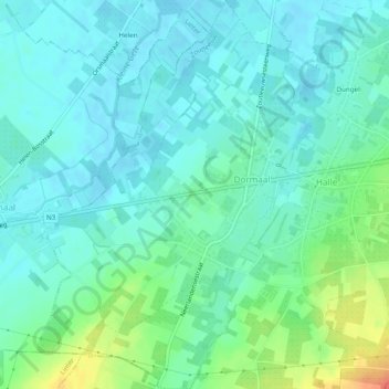
Name: Dormaal topographic map, elevation, terrain.
Location: Dormaal, Zoutleeuw, Leuven, Vlaams-Brabant, Vlaanderen, België (50.79104 5.07240 50.82167 5.10961)
Average elevation: 151 ft
Minimum elevation: 102 ft
Maximum elevation: 269 ft
Make a donation
Gear up for your next adventure:
As an Amazon Associate, this site earns from qualifying purchases at no extra cost to you.
Other topographic maps
Click on a map to view its topography, its elevation and its terrain.
Halle
België > Vlaams-Brabant > Leuven > Zoutleeuw
De kerk van Halle ligt op een hoogte van 46 meter. Een aantal holle wegen en kasseiwegen zijn in de omgeving te vinden. Ook loopt er, ten zuiden van het dorp, een voormalige Romeinse heerbaan, de Romeinse Steenweg.
Average elevation: 157 ft
Make a donation
Gear up for your next adventure:
As an Amazon Associate, this site earns from qualifying purchases at no extra cost to you.