Geolocate

Tongpal topographic map

Click on the map to display elevation.

About this map

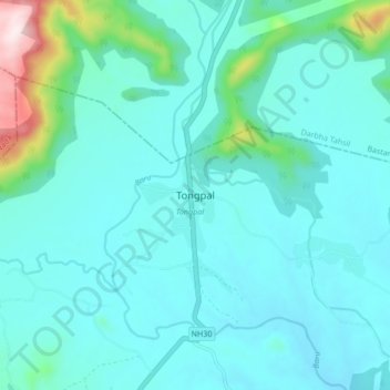
Name: Tongpal topographic map, elevation, terrain.

Location: Tongpal, Chhindgarh Tahsil, Sukma, Chhattisgarh, India (18.69267 81.77038 18.77267 81.85038)

Average elevation: 1,004 ft

Minimum elevation: 764 ft

Maximum elevation: 2,490 ft

Gear up for your next adventure:

🪶Survival Guide Book - Expert advice for emergency preparedness
🧤Hiking Gloves - Protective gloves for rugged trails
📷Action Cameras - Rugged cameras to document your journeys across rugged terrain
🛠️Outdoor Gear Repair Kit - Essential tools to fix gear on the trail
🎒Hydration Pack - Hands‑free water reservoir for long hikes

As an Amazon Associate, this site earns from qualifying purchases at no extra cost to you.