
Thank you for supporting this site ❤️
Make a donation
Make a donation
Gear up for your next adventure:
As an Amazon Associate, this site earns from qualifying purchases at no extra cost to you.
Nawli topographic map
Click on the map to display elevation.
Thank you for supporting this site ❤️
Make a donation
Make a donation
Gear up for your next adventure:
As an Amazon Associate, this site earns from qualifying purchases at no extra cost to you.
About this map
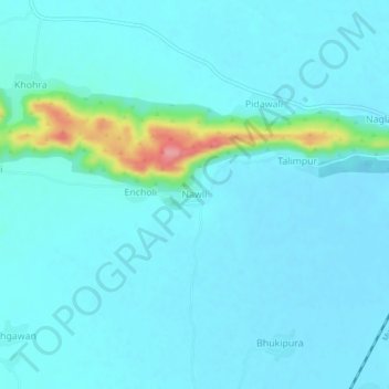
Name: Nawli topographic map, elevation, terrain.
Location: Nawli, Bayana Tehsil, Bharatpur, Rajasthan, India (26.98503 77.27249 27.02503 77.31249)
Average elevation: 666 ft
Minimum elevation: 620 ft
Maximum elevation: 984 ft
Thank you for supporting this site ❤️
Make a donation
Make a donation
Gear up for your next adventure:
As an Amazon Associate, this site earns from qualifying purchases at no extra cost to you.