
Hardegsen topographic map
Interactive map
Click on the map to display elevation.
Hardegsen
Hardegsen liegt westlich der Leine und östlich des Sollings, direkt am südwestlichen Rand des Höhenzuges Weper. Hardegsen wird von der Espolde durchflossen, in die im Stadtgebiet der Schöttelbach mündet.
About this map
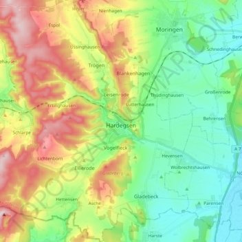
Name: Hardegsen topographic map, elevation, terrain.
Location: Hardegsen, Landkreis Northeim, Niedersachsen, 37181, Deutschland (51.59739 9.73164 51.71210 9.88756)
Average elevation: 784 ft
Minimum elevation: 417 ft
Maximum elevation: 1,430 ft