
Thank you for supporting this site ❤️
Make a donation
Make a donation
Gear up for your next adventure:
As an Amazon Associate, this site earns from qualifying purchases at no extra cost to you.
Kuñotambo topographic map
Click on the map to display elevation.
Thank you for supporting this site ❤️
Make a donation
Make a donation
Gear up for your next adventure:
As an Amazon Associate, this site earns from qualifying purchases at no extra cost to you.
About this map
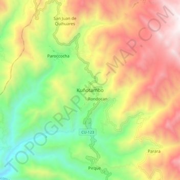
Name: Kuñotambo topographic map, elevation, terrain.
Location: Kuñotambo, Rondocan, Province of Acomayo, Cusco, Peru (-13.81541 -71.82532 -13.73541 -71.74532)
Average elevation: 11,690 ft
Minimum elevation: 9,068 ft
Maximum elevation: 14,770 ft
Thank you for supporting this site ❤️
Make a donation
Make a donation
Gear up for your next adventure:
As an Amazon Associate, this site earns from qualifying purchases at no extra cost to you.