
Corinna topographic map
Click on the map to display elevation.
About this map
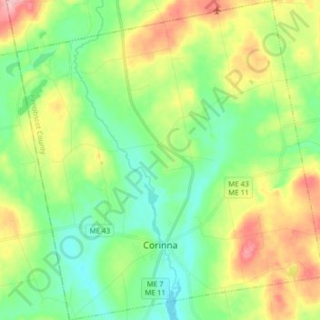
Name: Corinna topographic map, elevation, terrain.
Location: Corinna, Penobscot County, Maine, 04928, United States (44.89600 -69.33095 45.00444 -69.18353)
Average elevation: 344 ft
Minimum elevation: 187 ft
Maximum elevation: 630 ft
Penobscot County trails, hiking, mountain biking, running and outdoor activities
Other topographic maps
Click on a map to view its topography, its elevation and its terrain.