
Thank you for supporting this site ❤️
Make a donation
Make a donation
Gear up for your next adventure:
As an Amazon Associate, this site earns from qualifying purchases at no extra cost to you.
Bitai topographic map
Click on the map to display elevation.
Thank you for supporting this site ❤️
Make a donation
Make a donation
Gear up for your next adventure:
As an Amazon Associate, this site earns from qualifying purchases at no extra cost to you.
About this map
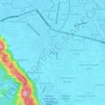
Name: Bitai topographic map, elevation, terrain.
Location: Bitai, Darul Imarah, Aceh Besar, Aceh, 23238, Indonesia (5.49247 95.28131 5.53247 95.32131)
Average elevation: 79 ft
Minimum elevation: 13 ft
Maximum elevation: 741 ft
Thank you for supporting this site ❤️
Make a donation
Make a donation
Gear up for your next adventure:
As an Amazon Associate, this site earns from qualifying purchases at no extra cost to you.