
El Castillo topographic map
Click on the map to display elevation.
About this map
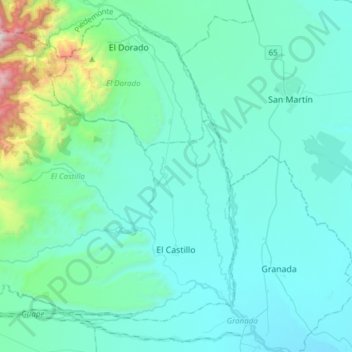
Name: El Castillo topographic map, elevation, terrain.
Location: El Castillo, Ariari, Meta, Colombia (3.50327 -74.04560 3.75342 -73.74202)
Average elevation: 2,936 ft
Minimum elevation: 1,017 ft
Maximum elevation: 13,553 ft