
Thank you for supporting this site ❤️
Make a donation
Make a donation
Gear up for your next adventure:
As an Amazon Associate, this site earns from qualifying purchases at no extra cost to you.
Maiburiji topographic map
Click on the map to display elevation.
Thank you for supporting this site ❤️
Make a donation
Make a donation
Gear up for your next adventure:
As an Amazon Associate, this site earns from qualifying purchases at no extra cost to you.
About this map
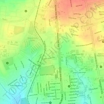
Name: Maiburiji topographic map, elevation, terrain.
Location: Maiburiji, Kaduna North, Kaduna, Nigeria (10.51148 7.42158 10.53465 7.43068)
Average elevation: 1,998 ft
Minimum elevation: 1,896 ft
Maximum elevation: 2,087 ft
Thank you for supporting this site ❤️
Make a donation
Make a donation
Gear up for your next adventure:
As an Amazon Associate, this site earns from qualifying purchases at no extra cost to you.