
Thank you for supporting this site ❤️
Make a donation
Make a donation
Gear up for your next adventure:
As an Amazon Associate, this site earns from qualifying purchases at no extra cost to you.
Badajoz topographic map
Click on the map to display elevation.
Thank you for supporting this site ❤️
Make a donation
Make a donation
Gear up for your next adventure:
As an Amazon Associate, this site earns from qualifying purchases at no extra cost to you.
About this map
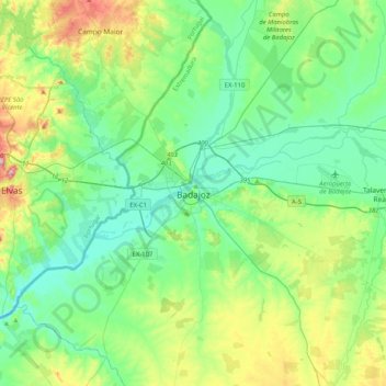
Name: Badajoz topographic map, elevation, terrain.
Location: Badajoz, Tierra de Badajoz, Badajoz, Extremadura, 06002, Spain (38.71806 -7.13020 39.03806 -6.81020)
Average elevation: 692 ft
Minimum elevation: 489 ft
Maximum elevation: 1,299 ft
Thank you for supporting this site ❤️
Make a donation
Make a donation
Gear up for your next adventure:
As an Amazon Associate, this site earns from qualifying purchases at no extra cost to you.