Geolocate

Pucruto topographic map

Click on the map to display elevation.

About this map

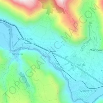
Name: Pucruto topographic map, elevation, terrain.

Location: Pucruto, Media luna, Urubamba, Cusco, 08660, Peru (-13.30923 -72.16534 -13.26923 -72.12534)

Average elevation: 10,007 ft

Minimum elevation: 9,281 ft

Maximum elevation: 12,051 ft

Gear up for your next adventure:

🥾Men's Hiking Boots - Durable, waterproof footwear for rugged terrain and steep inclines
🕶️Glacier Sunglasses - Side shields to protect eyes from high-altitude snow glare
Camping Coffee Makers - Enjoy premium coffee at the summit or campsite
🔌Solar Panel Charger - Charge gear sustainably outdoors
🦶Carbon Trekking Poles - Reduce knee impact on steep descents with ultra-light poles

As an Amazon Associate, this site earns from qualifying purchases at no extra cost to you.