
Thank you for supporting this site ❤️
Make a donation
Make a donation
Gear up for your next adventure:
As an Amazon Associate, this site earns from qualifying purchases at no extra cost to you.
Kobo topographic map
Click on the map to display elevation.
Thank you for supporting this site ❤️
Make a donation
Make a donation
Gear up for your next adventure:
As an Amazon Associate, this site earns from qualifying purchases at no extra cost to you.
About this map
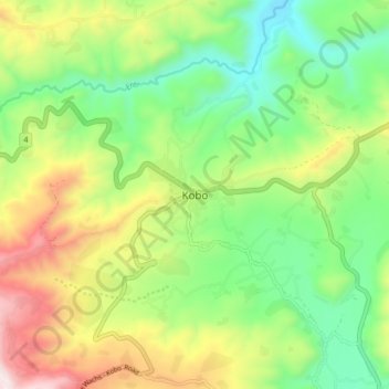
Name: Kobo topographic map, elevation, terrain.
Location: Kobo, East Harerghe, Oromia Region, Ethiopia (9.33641 41.43440 9.41641 41.51440)
Average elevation: 6,834 ft
Minimum elevation: 5,663 ft
Maximum elevation: 8,740 ft
Thank you for supporting this site ❤️
Make a donation
Make a donation
Gear up for your next adventure:
As an Amazon Associate, this site earns from qualifying purchases at no extra cost to you.