
Thank you for supporting this site ❤️
Make a donation
Make a donation
Gear up for your next adventure:
As an Amazon Associate, this site earns from qualifying purchases at no extra cost to you.
Monterosso topographic map
Click on the map to display elevation.
Thank you for supporting this site ❤️
Make a donation
Make a donation
Gear up for your next adventure:
As an Amazon Associate, this site earns from qualifying purchases at no extra cost to you.
About this map
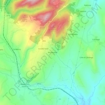
Name: Monterosso topographic map, elevation, terrain.
Location: Monterosso, Sassoferrato, Ancona, Marche, 60041, Italy (43.45409 12.81311 43.49409 12.85311)
Average elevation: 1,444 ft
Minimum elevation: 1,024 ft
Maximum elevation: 2,218 ft
Thank you for supporting this site ❤️
Make a donation
Make a donation
Gear up for your next adventure:
As an Amazon Associate, this site earns from qualifying purchases at no extra cost to you.