
Make a donation
Gear up for your next adventure:
As an Amazon Associate, this site earns from qualifying purchases at no extra cost to you.
Budaka topographic map
Click on the map to display elevation.
Make a donation
Gear up for your next adventure:
As an Amazon Associate, this site earns from qualifying purchases at no extra cost to you.
Budaka
Budaka is approximately 29 kilometres (18 mi) west of Mbale, the largest city in Uganda's Eastern Region, along the Iganga–Tirinyi–Kamonkoli–Mbale Road. It is approximately 225 kilometres (140 mi) north-east of Kampala, the capital and largest city of Uganda. The coordinates of the town are:01 01 00N, 33 56 42E (Latitude:1.0150; Longitude:33.9450). Budaka Town is situated at an average elevation of 1,160 metres (3,806 ft) above mean sea level.
Make a donation
Gear up for your next adventure:
As an Amazon Associate, this site earns from qualifying purchases at no extra cost to you.
About this map
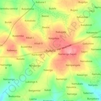
Name: Budaka topographic map, elevation, terrain.
Location: Budaka, Eastern Region, Uganda (0.97584 33.90907 1.05584 33.98907)
Average elevation: 3,665 ft
Minimum elevation: 3,501 ft
Maximum elevation: 3,829 ft
Make a donation
Gear up for your next adventure:
As an Amazon Associate, this site earns from qualifying purchases at no extra cost to you.