
Swanton topographic map
Click on the map to display elevation.
About this map
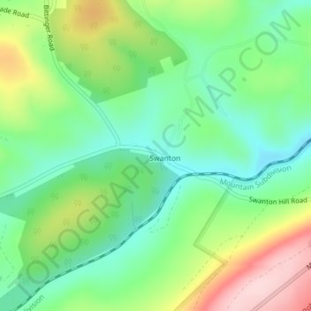
Name: Swanton topographic map, elevation, terrain.
Location: Swanton, Garrett County, Maryland, United States (39.45292 -79.23888 39.46552 -79.22565)
Average elevation: 2,536 ft
Minimum elevation: 2,244 ft
Maximum elevation: 3,051 ft
Garrett County trails, hiking, mountain biking, running and outdoor activities