
Thank you for supporting this site ❤️
Make a donation
Make a donation
Gear up for your next adventure:
As an Amazon Associate, this site earns from qualifying purchases at no extra cost to you.
Hara topographic map
Click on the map to display elevation.
Thank you for supporting this site ❤️
Make a donation
Make a donation
Gear up for your next adventure:
As an Amazon Associate, this site earns from qualifying purchases at no extra cost to you.
About this map
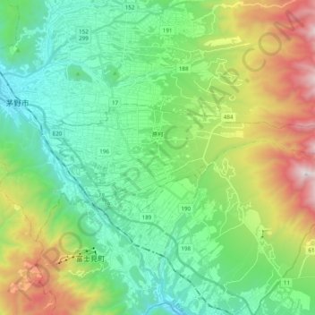
Name: Hara topographic map, elevation, terrain.
Location: Hara, Suwa County, Nagano Prefecture, 391-0104, Japan (35.93139 138.17726 35.98467 138.37046)
Average elevation: 4,052 ft
Minimum elevation: 2,493 ft
Maximum elevation: 7,776 ft
Thank you for supporting this site ❤️
Make a donation
Make a donation
Gear up for your next adventure:
As an Amazon Associate, this site earns from qualifying purchases at no extra cost to you.