
Make a donation
Gear up for your next adventure:
As an Amazon Associate, this site earns from qualifying purchases at no extra cost to you.
Woestijn topographic map
Click on the map to display elevation.
Make a donation
Gear up for your next adventure:
As an Amazon Associate, this site earns from qualifying purchases at no extra cost to you.
About this map
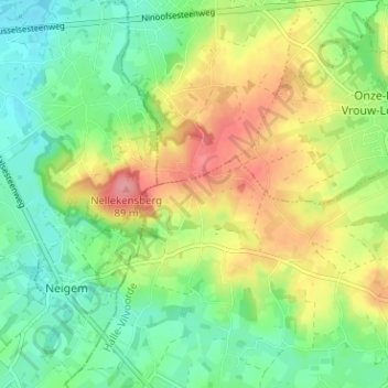
Name: Woestijn topographic map, elevation, terrain.
Average elevation: 154 ft
Minimum elevation: 36 ft
Maximum elevation: 331 ft
Make a donation
Gear up for your next adventure:
As an Amazon Associate, this site earns from qualifying purchases at no extra cost to you.
Other topographic maps
Click on a map to view its topography, its elevation and its terrain.
Galmaarden
België > Vlaams-Brabant > Halle-Vilvoorde > Pajottegem
Galmaarden ligt in het Pajottenland op een leemplateau en de hoogte bedraagt 25-108 meter. De Mark stroomt door Galmaarden.
Average elevation: 138 ft
Herne
België > Vlaams-Brabant > Halle-Vilvoorde > Pajottegem
Herne ligt in de vallei van de Mark op een hoogte van ongeveer 30 meter. Naar het zuidoosten loopt de hoogte op tot 69 meter.
Average elevation: 157 ft
Vollezele
België > Vlaams-Brabant > Halle-Vilvoorde > Pajottegem
Vollezele ligt in het Pajottenland op een hoogte van 32-105 meter. In het oosten liggen het Steenhoutbos en het Hellebos.
Average elevation: 167 ft
Sint-Pieters-Kapelle
België > Vlaams-Brabant > Halle-Vilvoorde > Pajottegem
De nomenclatuur van gehuchten en locaties is sterk geïnspireerd door de topografie en het daarmee samenhangend bodemgebruik. Torreborre, Rasbeek, Heisbeek, Roosbroek, Rijsgat en Laag Manhove verwijzen naar lage reliëfs. Hoog Manhove, Stevelberg en Heizei komen overeen met hogere delen in het landschap.
Average elevation: 174 ft
Make a donation
Gear up for your next adventure:
As an Amazon Associate, this site earns from qualifying purchases at no extra cost to you.
Herfelingen
België > Vlaams-Brabant > Halle-Vilvoorde > Pajottegem
Herfelingen ligt op een hoogte van 55-66 meter. Ten oosten van de kom loopt de Rasbeek in noordoostelijke richting.
Average elevation: 194 ft
Oetingen
België > Vlaams-Brabant > Halle-Vilvoorde > Pajottegem
Oetingen ligt op een hoogte van 35-100 meter. In het westen vindt men getuigenheuvels met daarop het Steenhoutbos en het Hellebos. Het Steenhoutbos is een deel van het Kasteeldomein Steenhout in Vollezele, maar waarvan het grootste deel van het land op het grondgebied van Oetingen ligt. Het gebied wordt…
Average elevation: 167 ft
Galmaarden
België > Vlaams-Brabant > Halle-Vilvoorde > Pajottegem
Galmaarden ligt in het Pajottenland op een leemplateau en de hoogte bedraagt 25-108 meter. De Mark stroomt door Galmaarden.
Average elevation: 138 ft
Make a donation
Gear up for your next adventure:
As an Amazon Associate, this site earns from qualifying purchases at no extra cost to you.