Geolocate

Bunian topographic map

Click on the map to display elevation.

About this map

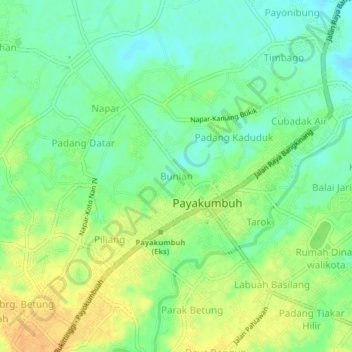
Name: Bunian topographic map, elevation, terrain.

Location: Bunian, Payakumbuh, West Sumatra, Sumatra, Indonesia (-0.24126 100.60841 -0.20126 100.64841)

Average elevation: 1,673 ft

Minimum elevation: 1,624 ft

Maximum elevation: 1,732 ft

Gear up for your next adventure:

🪓Survival Multi‑Tool - Versatile tool for camp and trail tasks
🪶Trail Camera - Capture wildlife on your hikes
🥤Water Filter Bottle - All‑in‑one filter bottle for safe hydration
🧥Waterproof Jacket for Hiking - Breathable and rugged rain jacket for outdoor excursions
📷Action Cameras - Rugged cameras to document your journeys across rugged terrain

As an Amazon Associate, this site earns from qualifying purchases at no extra cost to you.