
Thank you for supporting this site ❤️
Make a donation
Make a donation
Gear up for your next adventure:
As an Amazon Associate, this site earns from qualifying purchases at no extra cost to you.
Sarah topographic map
Click on the map to display elevation.
Thank you for supporting this site ❤️
Make a donation
Make a donation
Gear up for your next adventure:
As an Amazon Associate, this site earns from qualifying purchases at no extra cost to you.
About this map
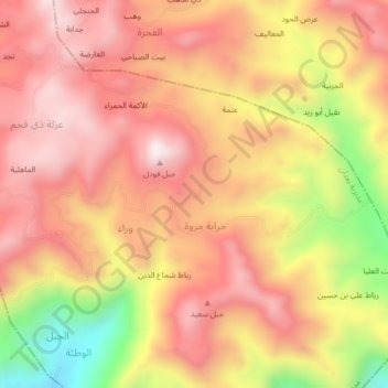
Name: Sarah topographic map, elevation, terrain.
Location: Sarah, Ba'dan District, Ibb Governorate, Yemen (13.91601 44.27081 13.95601 44.31081)
Average elevation: 7,490 ft
Minimum elevation: 5,909 ft
Maximum elevation: 8,406 ft
Thank you for supporting this site ❤️
Make a donation
Make a donation
Gear up for your next adventure:
As an Amazon Associate, this site earns from qualifying purchases at no extra cost to you.