
Thank you for supporting this site ❤️
Make a donation
Make a donation
Gear up for your next adventure:
As an Amazon Associate, this site earns from qualifying purchases at no extra cost to you.
Ettumanoor topographic map
Click on the map to display elevation.
Thank you for supporting this site ❤️
Make a donation
Make a donation
Gear up for your next adventure:
As an Amazon Associate, this site earns from qualifying purchases at no extra cost to you.
About this map
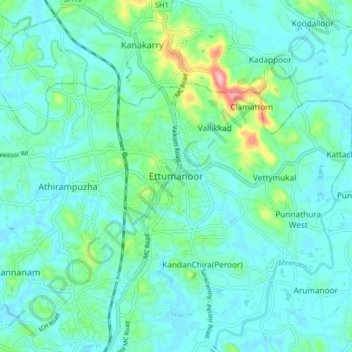
Name: Ettumanoor topographic map, elevation, terrain.
Location: Ettumanoor, Kottayam, Kerala, 686631, India (9.63018 76.51778 9.71018 76.59778)
Average elevation: 72 ft
Minimum elevation: -3 ft
Maximum elevation: 404 ft
Thank you for supporting this site ❤️
Make a donation
Make a donation
Gear up for your next adventure:
As an Amazon Associate, this site earns from qualifying purchases at no extra cost to you.