Geolocate

Achoora topographic map

Click on the map to display elevation.

About this map

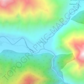
Name: Achoora topographic map, elevation, terrain.

Location: Achoora, Gurez, Bandipore District, Jammu and Kashmir, India (34.61409 74.85263 34.65409 74.89263)

Average elevation: 9,350 ft

Minimum elevation: 7,927 ft

Maximum elevation: 12,671 ft

Gear up for your next adventure:

🔭Compact Binoculars - HD vision for scouting terrain and identifying distant landmarks
🪶Compact Camp Shovel - Folding shovel for campsite tasks
😴Insulated Sleeping Pads - Compact and warm pads for high-elevation camping
🧦Merino Wool Socks - Moisture-wicking, blister-preventing socks for long treks
🧤Tactile Hiking Gloves - Keep hands warm while operating GPS and smartphone screens

As an Amazon Associate, this site earns from qualifying purchases at no extra cost to you.