Clear Lake topographic map
Interactive map
Click on the map to display elevation.
About this map
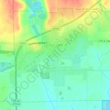
Name: Clear Lake topographic map, elevation, terrain.
Location: Clear Lake, Polk County, Wisconsin, United States (45.23786 -92.28591 45.26094 -92.24961)
Average elevation: 1,188 ft
Minimum elevation: 1,122 ft
Maximum elevation: 1,289 ft
Other topographic maps
Click on a map to view its topography, its elevation and its terrain.
Wild River State Park
United States > Wisconsin > Polk County
Wild River State Park, Town of Sterling, Polk County, Wisconsin, 54006, United States
Average elevation: 860 ft
Balsam Lake
United States > Wisconsin > Polk County
Balsam Lake, Polk County, Wisconsin, United States
Average elevation: 1,161 ft
Town of Bone Lake
United States > Wisconsin > Polk County
Town of Bone Lake, Polk County, Wisconsin, United States
Average elevation: 1,240 ft
Clayton
United States > Wisconsin > Polk County
Clayton, Polk County, Wisconsin, United States
Average elevation: 1,214 ft
Frederic
United States > Wisconsin > Polk County
Frederic, Polk County, Wisconsin, United States
Average elevation: 1,224 ft
Little Falls
United States > Wisconsin > Polk County
Little Falls, Town of Alden, Polk County, Wisconsin, United States
Average elevation: 1,070 ft
Peaslee Lake
United States > Wisconsin > Polk County
Peaslee Lake, Town of Osceola, Polk County, Wisconsin, United States
Average elevation: 791 ft
Clear Lake Village Park
United States > Wisconsin > Polk County > Clear Lake
Clear Lake Village Park, Clear Lake, Town of Clear Lake, Polk County, Wisconsin, United States
Average elevation: 1,207 ft
Cushing
United States > Wisconsin > Polk County
Cushing, Town of Laketown, Polk County, Wisconsin, 54006, United States
Average elevation: 978 ft
Amery
United States > Wisconsin > Polk County
Amery, Polk County, Wisconsin, United States
Average elevation: 1,083 ft